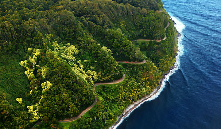
Hāna Highway
A 64.4-mile long stretch of Hawaii Routes 36 and 360 which connects Kahului with the town of Hāna in east Maui. On the east after Kalepa Bridge, the highway continues to Kīpahulu as Hawaii Route 31 (the Piilani Highway). Although Hāna is only about 52 miles from Kahului, it takes about 2.5 hours to drive when no stops are made as the highway is very winding and narrow and passes over 59 bridges, 46 of which are only one lane wide.
In August 2000, the highway was designated as the Hāna Millennium Legacy Trail by President Bill Clinton, with the trail start designated in Pāʻia. The Hāna Highway was listed on the National Register of Historic Places on June 15, 2001. Modern road construction to Hana began in the 1870s, with an unpaved road built to facilitate the construction of the Hämäkua Ditch. Part of The East Maui Irrigation System, the Hämäkua Ditch brought water from the rainforests of Haleakalā to semi-arid central Maui to support the sugarcane industry. Road construction continued in the early 1900s and was extended piecemeal until the full road to Hana was officially opened on December 18, 1926. Construction of bridges continued through the 1930s and the road was not completely paved until the 1960s.
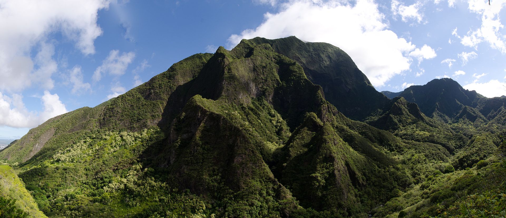
Iao Valley
A lush, stream-cut valley in West Maui located 3.1 mi west of Wailuku. In Hawaiian the name means “cloud supreme”. It was designated a National Natural Landmark in 1972.
The state park is located on 6.2 acres at the end of Iao Valley Road (Highway 32). The Iao Needle (Kūkaemoku) is a famous landmark in the state park, a vegetation-covered lava remnant rising 1,200 feet from the valley floor or 2,250 feet when measured from sea level. The “needle” itself is an illusion, and is in reality a sharp ridge that gives the appearance of being a spire when viewed end-on. The needle is an extension of and surrounded by the cliffs of the West Maui Mountains, an extinct volcano. One can take a short trail (Iao Needle Lookout Trail and Ethnobotanical Loop) to a windy overlook. The Puʻu Kukui summit area at the valley’s head receives an average 386 inches of rainfall per year, making it the state’s second wettest location after Mount Waiʻaleʻale. Much of this rainfall ends up flowing into the Iao Stream. Trails in the State Park run alongside Iao Stream and through the forest.
20th Century Fox’s 1997 motion picture Turbo: A Power Rangers Movie was partially filmed here.
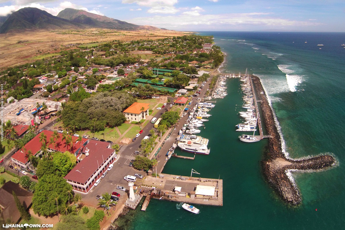
Lāhainā
The largest census-designated place (CDP) in West Maui and the gateway to the famous Ka’anapali and Kapalua beach resorts to its north. During the tourist season, the population can swell to nearly 40,000 people!
There are many different climates in the different districts of Lahaina. The historic district is the Dryest and calmest and hosts the small boat harbor. Kaanapali is north of a wind line and has double the annual rainfall and frequent breezes. The Kapalua and Napili areas have almost four times the annual rainfall compared to the historic district of Lahaina. The historic district has preserved 60 historic sites within a small area and they are managed by the Lahaina Restoration.
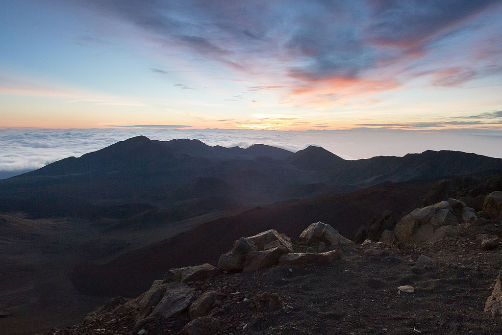
Haleakalā National Park
The park covers an area of 33,265 acres, of which 19,270 acres is a wilderness area. It was originally created as part of the Hawaii National Park along with the volcanoes of Mauna Loa and Kilauea on the island of Hawai’i in 1916. The name Haleakalā is Hawaiian for “house of the sun.” According to a local legend, the semigod Maui imprisoned the sun here in order to lengthen the day.
The park features the dormant Haleakalā (East Maui) Volcano, which last erupted sometime between 1480 and 1600 AD. The park is divided into two distinct sections: the summit area and the coastal Kipahulu area. The two sections of the park average 1,450,000 visitors per year!