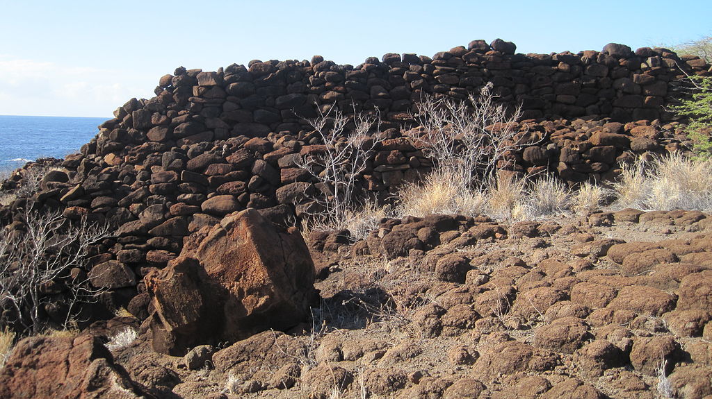
Kaunolu Village Site
Located on the south coast of the island, this former fishing village was abandoned in the 1880s and is the largest surviving ruins of a prehistoric Hawaiian village. The archaeological site is well preserved and covers almost every phase of Hawaiian culture. It was designated a U.S. National Historic Landmark in 1962.
The site consists of two historical villages straddling Kaunolū Gulch. The village on the western side was named Kaunolū and the one on the eastern side was called Keāliakapu. The land is parched, with little fresh water, but the sheltered bay at the end of the gulch offers access to rich fishing in the deep seas below the high cliffs along the south coast of the island.
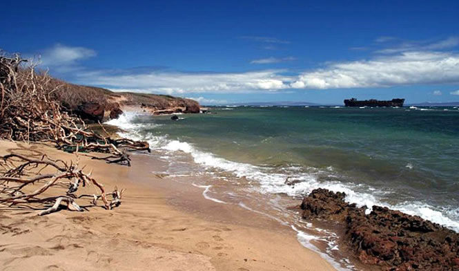
Shipwreck Beach
Located on the north shore of the island. This site is so named because of the remains of a wrecked vessel aground a short distance offshore. This is popularly referred to as a WWII Liberty Ship, although it is YOGN 42, one of the concrete barges built for the war in 1943.
The Alderman Wood, a British vessel got into trouble and sank here in 1824, which is the first documented shipwreck. Two years later, the London, an American ship, met its fate and was believed to have carried gold and silver on board. It is uncertain how much of it was ever recovered.
A short walk past the Shipwreck sign, there is a trail that leads about 200 yards inland to the Kukui Point petroglyphs.
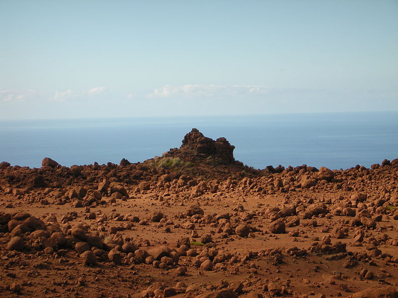
Garden of the Gods
Also known as Keahiakawelo, this rock garden is located at the end of rocky Polihua Road. Roughly 45 min from Lana’i City on the northwest side of the island, its mysterious lunar topography is populated with boulders and rock towers.
According to Hawaiian lore, this windswept landscape is the result of a contest between two kahuna from Lana’i and Moloka’i. Each was challenged to keep a fire burning on their respective island longer than the other, and the winner’s island would be rewarded with great abundance. The Lana’i kahuna, Kawelo, used every piece of vegetation in Keahiakawelo to keep his fire burning, which is why this area is so barren today.
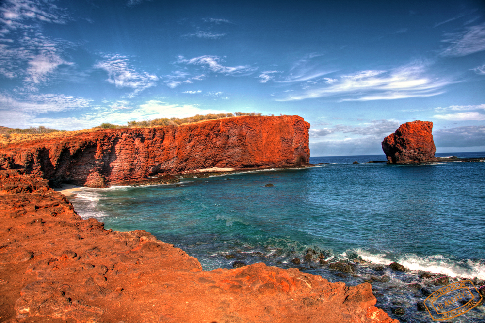
Sweetheart Rock
On the southern coast of the island is Hulopoe Bay and Lanai’s main boat harbor, Manele Bay. Rising from the sea just between these two bays is the iconic Puu Pehe, or Sweetheart Rock.
Legend tells of two lovers, a Hawaiian maiden named Pehe from Lahaina and a young warrior from Lanai named Makakehau. He was so taken with her beauty that whenever he laid eyes upon her they would mist up in tears. Hence his name: Maka (eyes) Kehau (mist). He took her back to Lanai and hid her in a sea cave at the base of Manele’s cliffs. One day while gathering supplies he noticed a storm brewing and headed back, only to find Pehe drowned by the surge of the storm waves. Stricken with grief, Makakehau gathered his beloved in his arms and wailed out to the gods to help him climb the steep rock island where he eventually buried her. He then jumped from this 80-foot summit into the pounding surf below.
Kanepuu Preserve
Located on the west side of Lana’i, it encompasses 590 acres and is home to 48 species of native plants. The Nature Conservancy protects this forest, which contains the largest remnants of olopua/lama dry land forest in Hawaii. This type of forest once covered much of the dry lowlands of the Hawaiian Islands. It is a rare opportunity to view rare, endemic plant species and trees like the lama, a native ebony, and aiea, once used for canoe building.
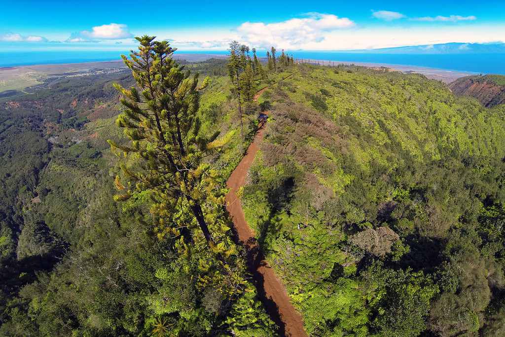
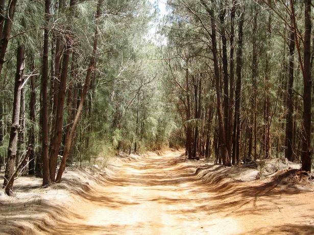
Munro Trail
It begins just north of Lanai City, past the stables of the Four Seasons Resort. Named for George Munro, the naturalist from New Zealand who arrived in 1890, this 12.8 mile, one-lane dirt road offers sweeping vistas amongst the local Cook pine trees introduced by Munro himself.
The 1,600-foot elevation takes you through a rain forest filled with ohia lehua, ironwood, eucalyptus and pine trees, as well as, taking you to the very top of Lanaihale, Lanai’s highest peak at 3,370 feet!