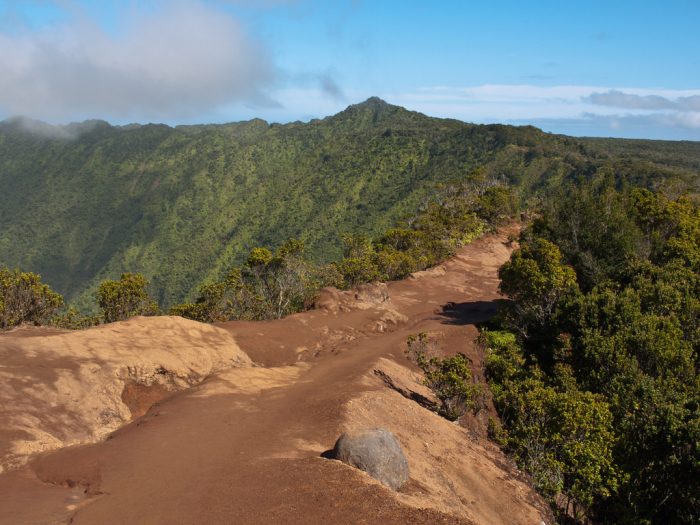
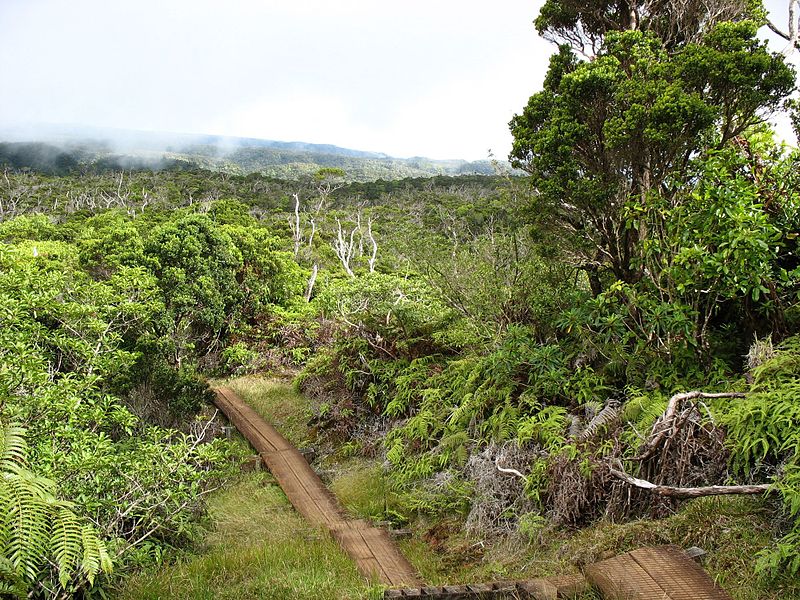
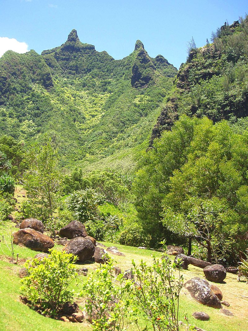
Koke’e State Park
Located in northwestern Kauaʻi it includes the Kōkeʻe Museum at the 15 mi marker on State Road 550, which focuses on the weather, vegetation, and bird life; a lodge which serves food and sells gifts; cabins for rent; and hiking trails.
The main attractions of Kōkeʻe State Park trails are the native vegetation, native forest birds, and the scenic cliffside views. Situated on a plateau between 3,200 and 4,200 ft, much of Kōkeʻe is a montane (infrequent frost) mesic forest (50 to 100 in annual rainfall with moist soil conditions) dominated by koa and ʻōhiʻa lehua trees. At the end of the state road is a lookout onto the Kalalau Valley, once home to thousands of native Hawaiians.
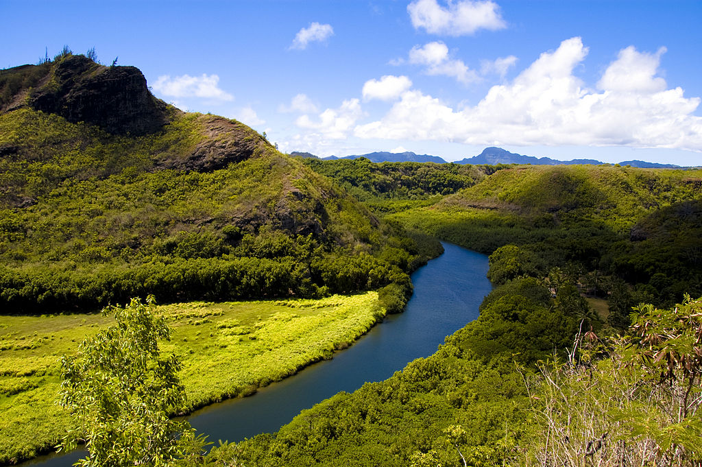
Wailuā River
A 20-mile-long river formed by the confluence of its North and South forks just west of Wailua and enters the Pacific Ocean. It is the only navigable river (by boats larger than kayaks) in the Hawaiian Islands and it is a center of activity for locals and visitors in the form of boat tours to Fern Grotto, kayaking and water skiing.
Other points of interest along the river system include a bird refuge, Kamokila Hawaiian Village, Secret Falls and a pool with a rope swing.
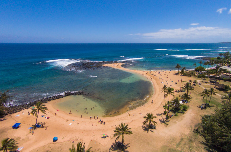
Poipu Beach Park
Located in the community of Poʻipū on the southern coast. There are swimming and snorkeling areas, and a surf break over a reef for experienced surfers only.
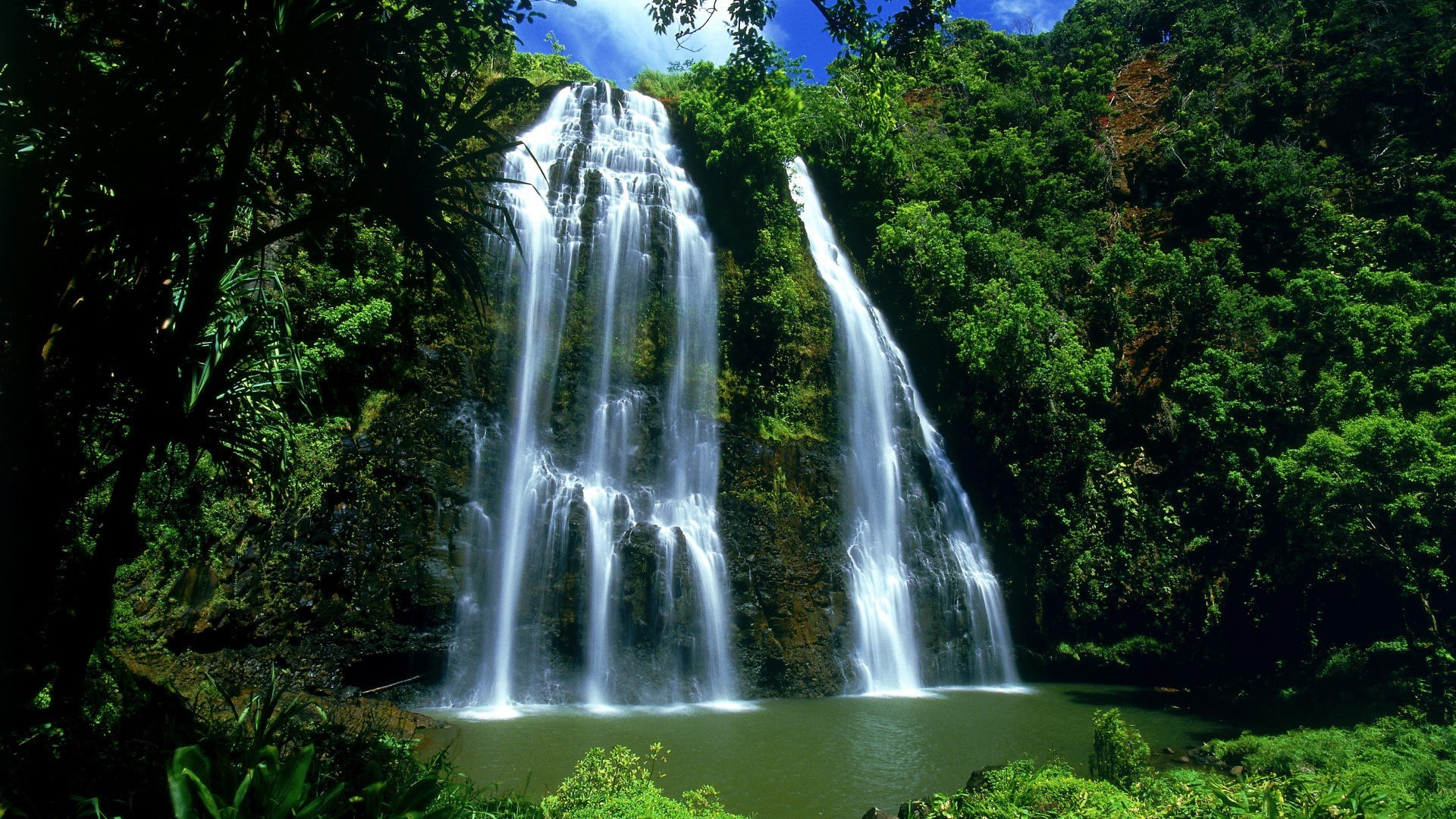
ʻŌpaekaʻa Falls
A waterfall located on the ʻŌpaekaʻa Stream in Wailua River State Park on the eastern side. It is 151-feet high and it flows over basalt from volcanic eruptions millions of years ago. Below the ridge down into the ravine through which the water falls can be seen the vertical dikes of basalt that cut through the horizontal Koloa lava flows. The name “ʻŌpaekaʻa” means rolling shrimp, “ʻopae” being Hawaiian for “shrimp,” and “kaʻa” for “rolling”. The name dates back to days when the native freshwater shrimp ‘Atyoida bisulcata‘ were plentiful in the stream and were seen rolling and tumbling down the falls and into the churning waters at the fall’s base.
Visually, this is a spectacular waterfall and is one of the island’s few waterfalls that can be seen from the road. It flows year round and therefore is not seasonal. Most of the time it falls in a double cascade but the two sides may become one after a heavy rain. Nearby is the Bell Stone believed to have been used by ancient Hawaiians to ward off danger. Striking the bell with another stone results in a distinctive low frequency sound that can be heard for at least a mile down the valley.
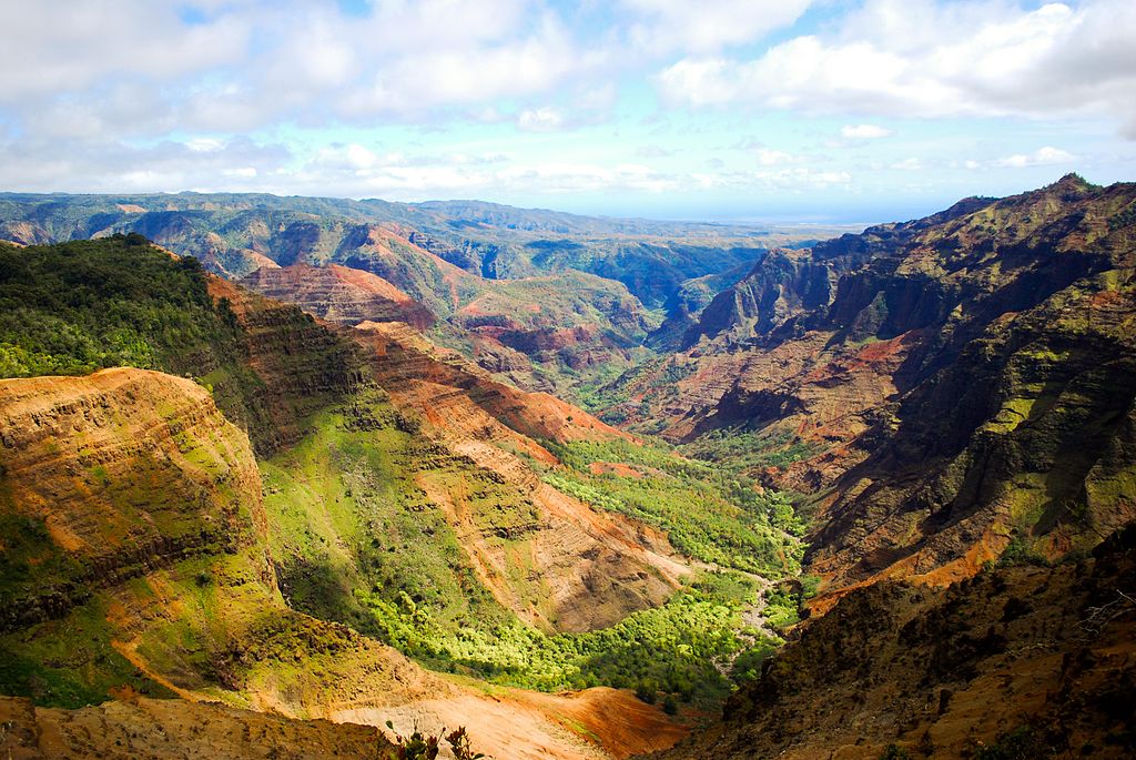
Waimea Canyon State Park
Also known as the Grand Canyon of the Pacific, it is a large canyon, approximately ten miles long and up to 3,000 feet deep, located on the western side of Kauaʻi. Waimea is Hawaiian for “reddish water”, a reference to the erosion of the canyon’s red soil. The canyon was formed by a deep incision of the Waimea River arising from the extreme rainfall on the island’s central peak, Mount Waiʻaleʻale, among the wettest places on earth.
It can be accessed from Waimea on Hawaiʻi state road 550, which is 18 miles long and leads up to Koke’e State Park.
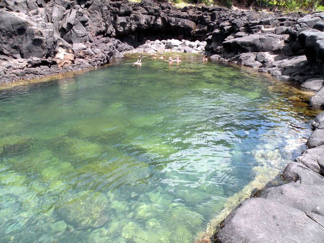
Queen’s Bath
The pool is a sinkhole surrounded by igneous rock. It is located on the north shore of Kauaʻi in the town of Princeville. The swimming area is accessible via a short trail. In the winter during periods of high surf it is considered dangerous. n small surf—usually in the summer—the water in the pool is calm. Small fish and tiny sea life also live in the tide pool, such as Hawaiʻian sea urchins, angelfish and the so-called “ghost fish”.
In ancient times only the Ali’i were permitted entry to the sacred waters.
Sleeping Giant
Also known as Nounou Mountain, is a mountain ridge located west of the towns Wailua and Kapa’a in the Nounou Forest Reserve. The formation received its common English name both from its resemblance to a reclining human figure, and from a Native Hawaiian legend about a giant who, after great labor or overeating, lay to rest and is yet to awaken.
Hiking trails lead to the highest point of the ridge, or what resembles a forehead.
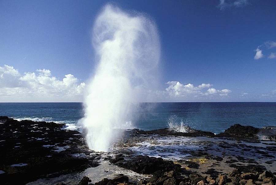
Spouting Horn
Located in the Koloa district on the southern coast, this area of Kauai is known for its crashing waves. These waves erode lava rocks on the coastline which can create narrow openings, as is the case with Spouting Horn. With every wave, water shoots upward when it is forced through an opening and creates a sound suggestive of hissing. The spray can shoot as high as 50 feet in the air.
The original Hawaiian name was puhi, meaning blowhole.
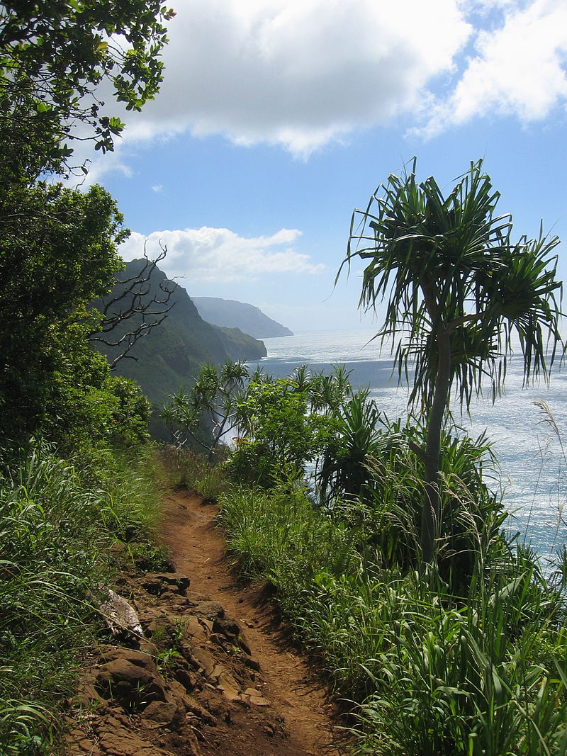
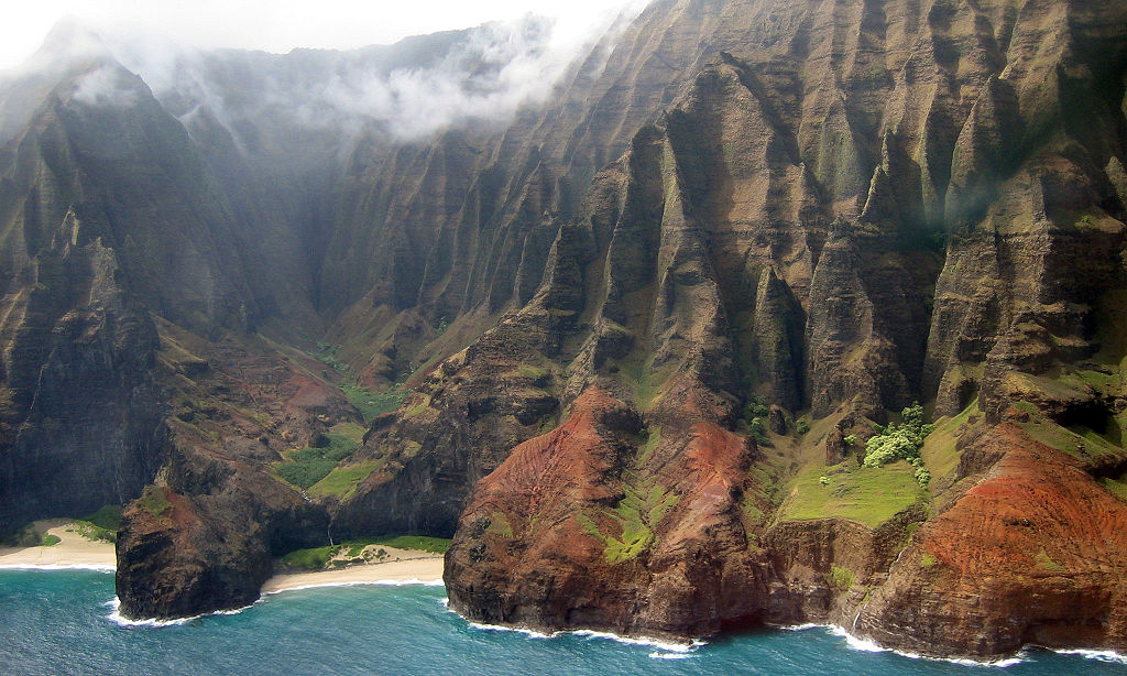
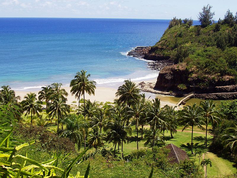
Nā Pali Coast State Park
a 6,175 acre state park located in the center of the rugged 16 miles along the northwest side. The Nā Pali coast itself extends southwest starting at Keʻe Beach extending all the way to Polihale State Park. The na pali (high cliffs) along the shoreline rise as much as 4,000 feet above the Pacific Ocean. The state park was formed to protect the Kalalau Valley.
Although inaccessible to vehicles, this coast can be enjoyed over land by hiking or in a helicopter, and from the ocean by kayak and paddleboard. Charter tours are available on rigid-hulled inflatable boat or catamaran, originating from Port Allen and Hanalei Bay.
Honopū Valley
A landmark valley within Nā Pali Coast State Park along the northwest shore. It is known for its distinctive natural arch, which at approximately 90 feet tall. At the lower end of the valley is Honopū’s secluded, 0.25-mile beach, also known as Cathedral Beach. Honopū means “conch shell”, and the valley’s name is derived from the conch shell-like sound its arch makes when hit by winds from the north.
It is isolated and not easily accessible except by water. No landing of any aircraft or boat is allowed in Honopū Valley or on its beach, so visitors must swim from an offshore boat or from neighboring Kalalau Beach.
The valley is also known as “the valley of the lost tribe” because it was the home of the last menehune.
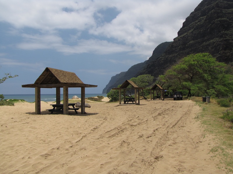
Polihale State Park
A remote wild beach on the western side of the island. It is the most western publicly accessible area in Hawaii. The park is miles away from the town of Kekaha, and it can only be reached via a poorly marked, dirt sugarcane road, making a four-wheel drive vehicle preferable. The beach is several miles long, yet only the area known as “Queen’s Pond” offers safe swimming. It has many miles of shoreline that averages about 300 feet from the barrier dunes to the surf line. Sand dunes along the beach can reach heights nearing 100 feet. On the east side park is adjacent to the field used for agriculture, that is in turn adjacent to the mountain ridge. Mountains are so close that at night park visitors can hear goats bleating on this ridge.
The foregoing story, however, offers an erroneous translation of the place name. The name “Polihale” literally translates as “House Bosom”. The root Po refers to the original night/darkness from which creation is manifested. Po in this case is the “source”; poli, is literally “bosom” or “breast”, revealing the word’s root in the concept of “source of life”. “Polihale” should not be literally translated as “bosom house”, but “house bosom”.
A sea lettuce called pahapaha grows in the waters near Polihale. A wreath made from pahapaha can fade and dry out, but when soaked in water, it will revive to its original freshness. Only the pahapaha from Polihale does this. According to mythology, Na-maka-o-Kaha’i, sister of Pele and Goddess of the Ocean, blessed Polihale’s pahapaha with this special quality.
Makaleha Mountains
A mountain range in Kauai County on the eastern side of the island. The highest point is 3,071 feet above sea level.
Alakai Wilderness Preserve
Popularly known as Alakaʻi Swamp, is a montane wet forest. Although the preserve is home to alpine bogs, it is actually not a true swamp. It is located on a plateau near Mount Waiʻaleʻale, one of the wettest spots on Earth.
The 3.5-mile Alakaʻi Swamp trail is often shrouded in mist. This trail can be reached via the Pihea Vista trail, which is connected to the Puʻu o Kila lookout on Waimea Canyon road. This road is located behind a gate that is directly next to the Kalalau Valley lookout. Due to the rainfall experienced here, potholes are formed and the road is often closed. The end of this trail overlooks Hanalei Bay off in the distance and it is possible to see several waterfalls from the lookout.
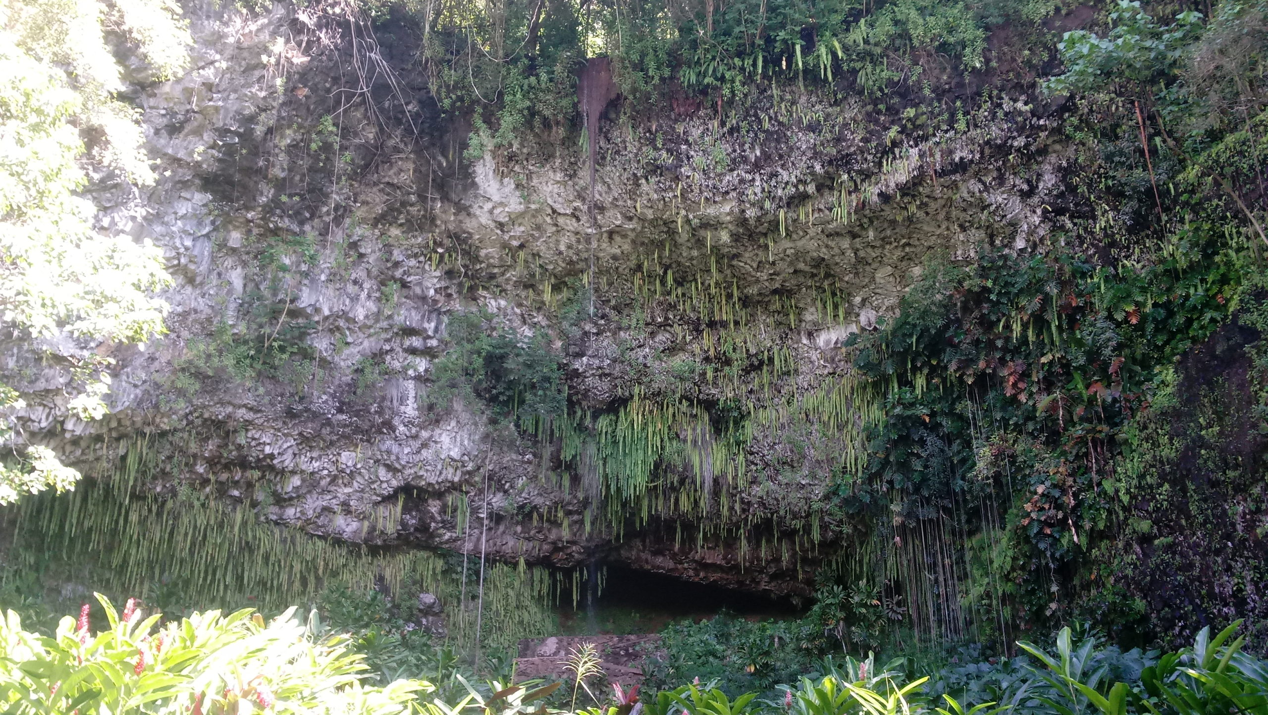
Fern Grotto
A fern covered, lava rock grotto located on the Wailua River on the eastern side of the island. It forms a natural amphitheater which greatly increases the acoustics of the many bands that are hired to perform live music, which has traditional themes. Several boat companies give river tours which lead to the grotto.
Access to the Grotto is by boat on the Wailua River as part of the Wailua River State Park. Tour boats ply the waters of the park and the Grotto has long been a popular stop on the tour. Fern Grotto was nearly destroyed when the island of Kauai was hit by hurricane Iniki in 1992. Most of the ferns hanging from the grotto were torn from the rocks and even though much of the plant life has rebounded, the grotto has yet to recover much of the grandeur for which it was previously known. It still remains one of the most popular and beautiful spots on the island.
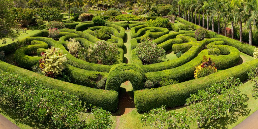
Na ‘Aina Kai Botanical Gardens
Over 240 acres (including forest and farmland) of nonprofit botanical gardens located at 4101 Wailapa Road, Kīlauea. Na ʻĀina Kai was established by Joyce and Ed Doty in 1982. In 1999, it became a nonprofit organization and opened to the public. Today it contains 13 gardens, a hardwood plantation, farmland, meadow, canyon, and beach. More than 90 bronze sculptures are sited throughout the estate.
A variety of guided tours are offered Tuesday through Friday; an admission fee is charged for each.
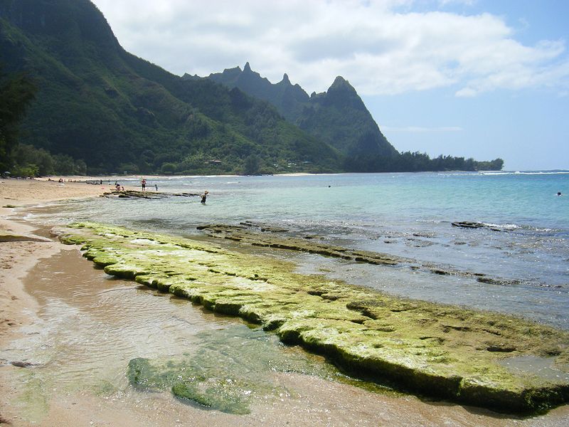
Haʻena State Park
A state park located on the north shore. It is often referred to as the “end of the road” and marks the end point of the Kuhio Highway. The park provides access to beaches, trails, and several ancient Hawaiian sites, including sea caves estimated to be more than 4,000 years old. Archaeological sites associated with the hula, including a heiau (shrine) dedicated to Laka, are located above the park’s beaches.
Kēʻē Beach is located at the western edge of the park while Hāʻena Beach is located just to the east of Haʻena State Park.
Haena is Hawaiian and literally translates to “red hot”.
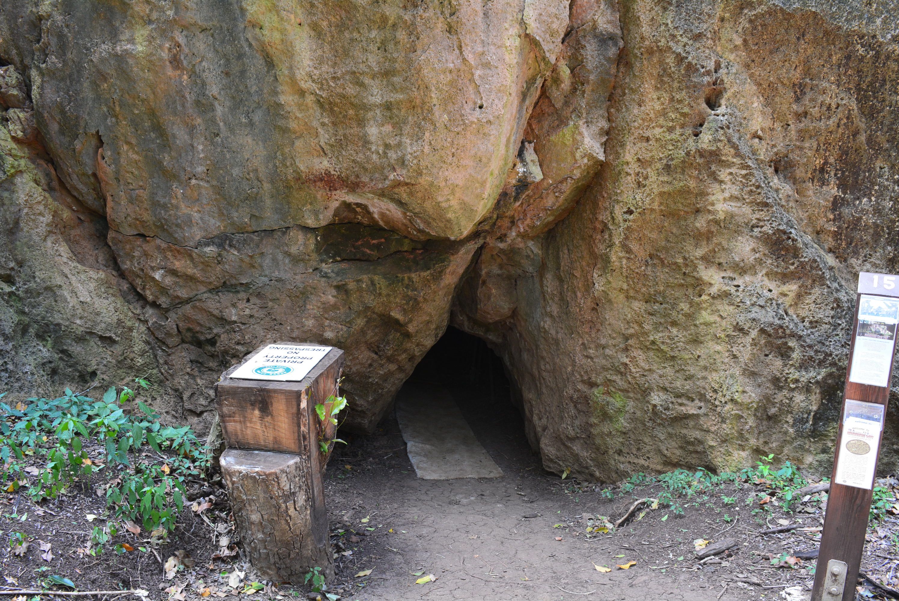
Makauwahi Cave
The largest limestone cave found in Hawaii. It lies on the south coast of the island of Kaua’i, in the Māhāʻulepū Valley close to Māhāʻulepū Beach, and is important for its paleoecological and archaeological values. It is reached via a sinkhole and has been described as “…maybe the richest fossil site in the Hawaiian Islands, perhaps in the entire Pacific Island region”.
It was used as a grave site by ancient Hawaiians. The paleolake within the sinkhole contains nearly 10,000 years of sedimentary record; since the discovery of Makauwahi as a fossil site, excavations have found pollen, seeds, diatoms, invertebrate shells, and Polynesian artifacts, as well as thousands of bird and fish bones.
Allerton Garden
Also known as Lāwaʻi-kai, it is a botanical garden originally created by Robert Allerton and John Gregg Allerton, located on the south shore. The garden covers an 80-acre area and is situated beside the Lāwaʻi Bay, in a valley transected by the Lāwaʻi Stream. It is one of the five gardens of the non-profit National Tropical Botanical Garden.
In 1938, Robert and John came to Hawaii and purchased a relatively small portion of Queen Emma’s plantation for a residence and gardens. They quickly began designing the landscape master plan and individual gardens, incorporating Hawaiian and new plants they had acquired from tropical Asia and other Pacific Islands, built landscape elements, and sculptures from “The Farms.”
McBryde Garden
A 200 acre botanical garden located on the south shore of the island. It is one of five gardens of the non-profit National Tropical Botanical Garden. The garden is situated above Lāwaʻi Bay, in a valley transected by the Lāwaʻi Stream. Queen Emma of Hawaii resided above this valley for a short interval, and a modest house that was perhaps her residence has subsequently been moved to the valley floor and renovated. The valley was purchased by the McBryde family in the late 19th century for a sugarcane plantation. This first garden of the National Tropical Botanical Garden (then Pacific Tropical Botanical Garden) was started in 1970 with the purchase of 171 acres by the institution and has since expanded. Initially called Lāwaʻi Garden, the site was renamed in 2000 as a result of a generous donation from the McBryde descendants.
Today, McBryde Garden serves as a research and conservation garden. It is home to the largest ex situ collection of native Hawaiian flora in the world, as well as extensive plantings of palms, flowering trees, heliconias, orchids and other plants collected from tropical regions.
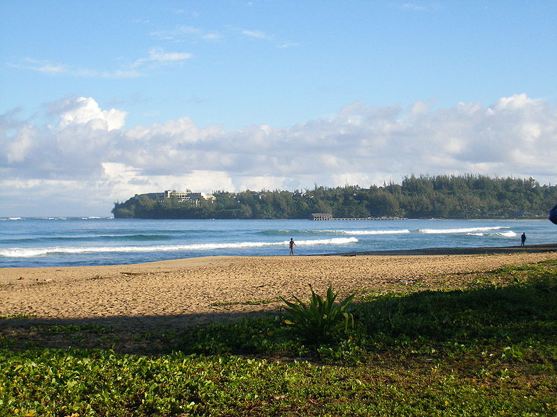
Hanalei Bay
The largest bay on the north shore with the town of Hanalei located at the midpoint of the bay. Hanalei Bay consists of nearly two miles of beach, surrounded by mountains. In the summer, the bay offers excellent mooring for sailboats, stand up paddle boarding and swimming. The Princeville community overlooks from the northeast entrance to the bay of Hanalei River.
The wetlands of Hanalei Bay were used to grow taro by ancient Hawaiians. By the 1860s, the new crop was rice, which was shipped to Honolulu to become the second largest export crop of the islands. The Hanalei Pier was built to help Hanalei farmers move their crops to market. The covered pier’s location near the mouth of the Hanalei River and Black Pot beach has long been a favorite family gathering place for fishing, picnicking, swimming, and playing.
The bay also served as a filming location for the 1958 film South Pacific and for the 2011 film The Descendants.
Limahuli Garden and Preserve
A botanical garden and nature preserve on the north shore. It is composed of 17 acres of garden & 985 acres of preserve. Limahuli lies within a tropical valley covering three distinct ecological zones. It is inland from the Haʻena State Park and Keʻe beach off of Route 560 (near its western end). The Makana Mountain ridge looms behind, and the Limahuli Stream includes an 800-foot waterfall on its descent from the valley’s high end at 3,330 feet to sea level just below the garden. The name comes from lima huli which means “turned hand” in the Hawaiian language.
The garden contains a wide range of native and Polynesian-introduced plants, including kukui, banana, breadfruit, alula, Paper Mulberry, papala, kī, turmeric, hāhā, lama, vegetable fern, ginger, hau kuahiwi, hibiscus including kokiʻo keʻokeʻo, kava, koa, nehe, ʻōhiʻa lehua, pokulakalaka, kului, hala, pāpala kēpau, plumeria, loʻulu, sugarcane, taro, and iliau. It also contains taro terraces (loʻi kalo) that date back to early Polynesian arrivals on the island.
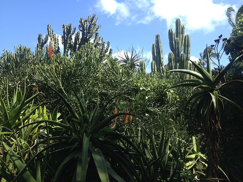
Moir Gardens
Botanical gardens located within the Outrigger Kiahuna Plantation on 2253 Poipu Road. They are open daily without charge.
The gardens were created in the 1930s by Alexandra Moir while her husband was manager of Hawaii’s first sugarcane plantation, Koloa Plantation, near the site. By 1948 the private gardens were reportedly identified as “one of the ten best cactus and succulent gardens in the world.” They opened to the public in 1954. Today, the garden contains rare cactus and succulents, bromeliads, orchids, mature trees, and water lily ponds.