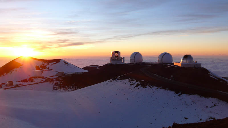
Mauna Kea Observatories
A number of independent astronomical research facilities and large telescope observatories that are located at the summit of Mauna Kea. The facilities are located in a 525-acre special land use zone known as the “Astronomy Precinct”, which is located within the 11,228-acre Mauna Kea Science Reserve. The “Astronomy Precinct” was established in 1967 and is located on land protected by the Historical Preservation Act for its significance to Hawaiian culture. The location is ideal because of its dark skies, good astronomical seeing, low humidity & position above most of the water vapor in the atmosphere, clean air, good weather and almost equatorial location. The summit of Mauna Kea is so high (9,300 feet) that tourists are advised to stop at the visitor station for at least 30 minutes to acclimate to atmospheric conditions before continuing to the summit, and scientists often stay at Hale Pōhaku for 8 hours or more before spending a full night at observatories on the summit.
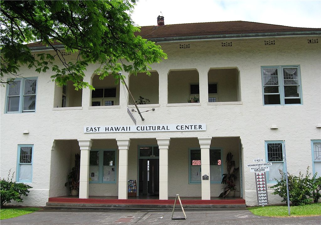
East Hawaii Cultural Center
A cultural center in Hilo, Hawaii, that has regular art exhibits and holds workshops and classes. Administered by the East Hawaii Cultural Council, an umbrella group of local arts organizations, the Center is housed in a historic former police station facing Kalakaua Park. The building itself was erected on September 4th, 1979.
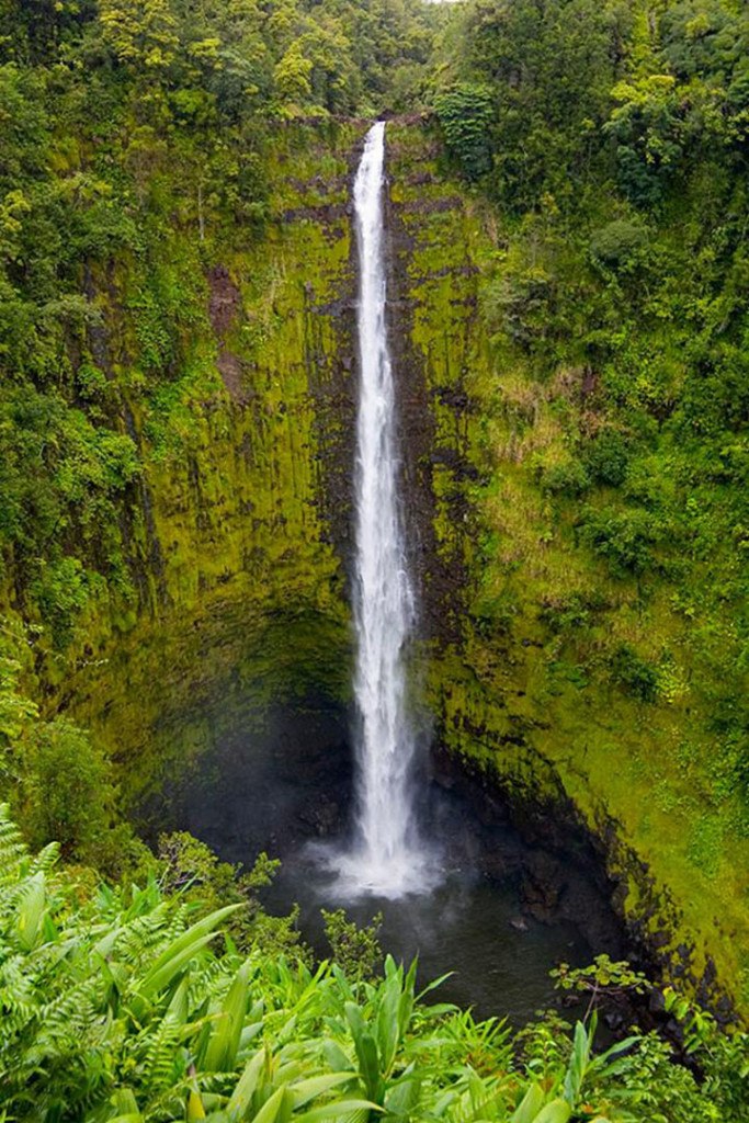
Akaka Falls
Located 11 miles (18 km) north from Hilo, west of Honomū off the Hawaii Belt Road (route 19) at the end of Hawaii Route 220. The Fall itself is 442 feet (135 m) tall. ʻAkaka in the Hawaiian language means “A rent, split, chink, separation; to crack, split, scale”. A large stone in the stream connected to the falls about 70 feet (21 m) upstream is called “Pōhaku o Kāloa”.
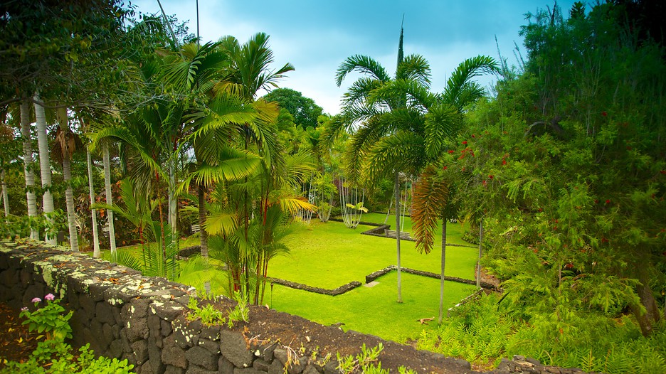
Sadie Seymour Botanical Gardens
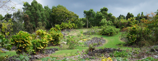
A nonprofit botanical garden located on the grounds of the Kona Educational Foundation Center at 76-6280 Kuakini Highway, Kailua-Kona. Open daily; admission is free, but donations accepted. Sadie Seymour (1907–1975) founded the outdoor circle to capture and beautify the Kona community. The gardens were designed by landscape architect, Scott Seymour on a wedge-shaped plot, and named in honor of his mother. They feature the cultivated plants of Hawaiʻi, arranged in 11 tiers by geographic origin. The first tier contains native Hawaiian plants with the other tiers including Australia, New Zealand, and Indonesia (featuring plants such as cuphea, eucalyptus, and ixora); Indo-Asia (lemon grass, and cinnamon, turmeric, and clove trees); Africa (Bismarckia nobilis); and Central America (calabash).
The grounds also contain an archaeological site called “Kealakowaʻa Heiau”. This ritual site, built in the time of King ʻUmi a Liloa, was used for construction and blessing of canoes.
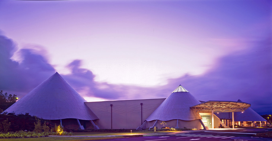
Imiloa Astronomy Center of Hawaii
An astronomy and culture education center located in Hilo, Hawaii. It features exhibits and shows dealing with Hawaiian culture and history, astronomy and the overlap between the two. There is a 120-seat planetarium, which features a fulldome video projection system. Planetarium presentations include ‘Imiloa’s exclusive signature show, “Maunakea: Between Earth and Sky.” The bilingual exhibits (in Hawaiian and English) offer two views of Origins and Voyages, presenting the tools, visions and discoveries of the astronomers and the Polynesian voyagers. The first group of whom are thought to have voyaged to Hawaii from the Marquesas Islands. Another planetarium show, “Dawn of the Space Age 3D,” recounts the early days of space exploration, the so-called space race between the USSR and the United States.
It opened to the public in February, 2006 and is located at 600 ‘Imiloa Place in Hilo, just north of Hawaii Route 2000 (Pūʻāinakō Street).
World Botanical Gardens
A commercial botanical gardens with a large waterfall, located between Umauma and Hakalau, at the corner of Leopolino Road and Hawaii Belt Rd., State Highway 19, 16 miles north of Hilo. The gardens are open daily with an admission fee with major features including Kamaʻeʻe Falls, a 100-foot (30 m) waterfall and the second largest maze in Hawaii known as the “Children’s Maze”, over 10 acres (0.040 km2) of arboretum.
The gardens were founded by Walter L. Wagner in 1995, who purchased 300 acres of agricultural land bordered by the Umauma River and extending up Mauna Kea’s slope from the failing sugarcane companies that formerly dominated the Hamakua coast. The Rainforest Walk was the first portion open to public touring on July 4, 1995.
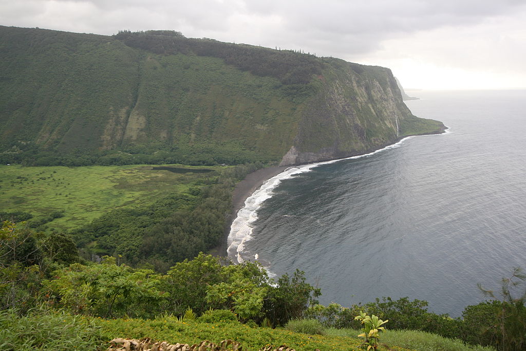
Waipio Valley
A valley located in the Hamakua District of the Big Island. “Waipiʻo” means “curved water” in the Hawaiian language. It was the capital and permanent residence of many early Hawaiian aliʻi up until the time of King ʻUmi. A place celebrated for its “nioi” tree known as the “Nioi wela o Paʻakalana” (The burning Nioi of Paʻakalana). It was also the location of the ancient grass palace of the ancient kings of Hawaii with the nioi stands. Kahekili II raided Waipiʻo in the 18th century and burned the four sacred trees to the ground.
The valley floor at sea level is almost 2,000 ft below the surrounding terrain. A steep road leads down into the valley from a lookout point located on the top of the southern wall of the valley. The road gains 800 vertical feet in 0.6 miles at a 25% average grade, with steeper grades in sections. This is a paved public road but it is open only to 4 wheel drive vehicles. A foot trail called “Waimanu” or Muliwai Trail leads down a steep path to the Waimanu Valley, which is not accessible by automobile. At upper end of the valley, Waimanu Gap at 2,089 feet elevation leads to the south end of Waimanu Valley.
The valley was the site of the final scene in the 1995 sci-fi film Waterworld, at which the main characters found dry land.
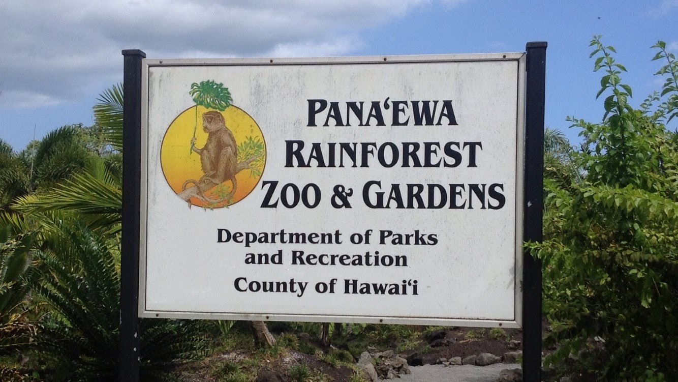
Pana’ewa Rainforest Zoo
This small 12-acre zoo is the only one in the United States located in a rainforest. It is operated by Hawaii County and receives its funding from the county and from private donations. It has more than 60 species of animals on display, and the grounds feature more than 40 different species of plants, flowers, and trees.
The most popular attraction of the zoo was a male white Bengal tiger named Namaste’ (named after the traditional namaste greeting). Namaste died on January 16th, 2014.
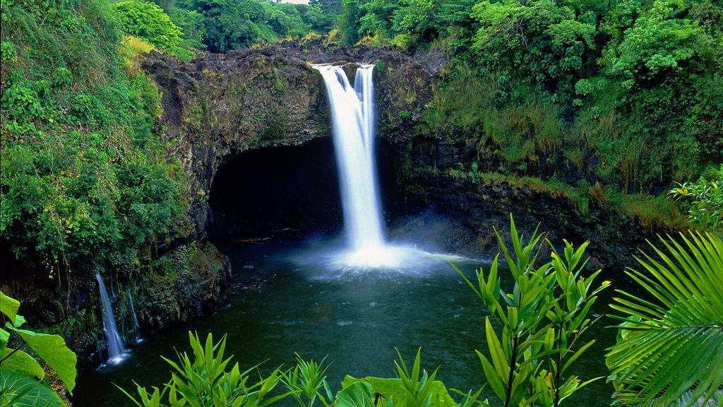
Rainbow Falls
It is 80 ft tall and almost 100 ft in diameter. The falls are part of the Hawai’i State Parks and there is no fee to see the falls. Known in the Hawaiian language as Waiānuenue (literally “rainbow water”), the falls flows over a natural lava cave, the mythological home to Hina, an ancient Hawaiian goddess. The gorge is blanketed by lush, dense nonnative tropical rainforest and the turquoise colored pool is bordered by beautiful, although nonnative, wild ginger.
Lyman House Memorial Museum
Also known as the “Lyman Museum”, it is a natural history museum founded in 1931 in the Lyman family mission house, originally built in 1838. The main collections were moved to an adjacent modern building in the 1960s, while the house is open for tours as the island’s oldest surviving wood-framed building. It has extensive displays on Hawaiian culture and is renowned for its collection of shells and minerals, including a specimen of orlymanite, named for Orlando Hammond Lyman (1903–1986), the museum’s founder and great grandson of David and Sarah Lyman.
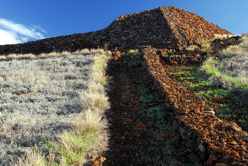
Puʻukoholā Heiau National Historic Site
The site preserves the National Historic Landmark ruins of the last major Ancient Hawaiian temple, and other historic sites. A respected kahuna (priest) named Kapoukahi suggested building a ‘luakini heiau’ (sacrificial temple) to gain the favor of the war god, Kūkaʻilimoku. ‘Puʻukoholā Heiau’ meaning “Temple on the Hill of the Whale” was the result, probably on the site of an older temple from about 1580. It was built entirely by hand with no mortar, in less than a year. The red stones were transported by a human chain about 14 miles long, from Pololū Valley to the East. Construction was supervised by Kamehameha’s brother Keliʻimaika’i, involving thousands of people.
The ship Fair American had been captured in 1790, along with one surviving crew member Isaac Davis, after the incident at Olowalu. Davis and a stranded British sailor named John Young became important military advisors to King Kamehameha. John Young built a house and ranch nearby, and that site is also within the park. Unfortunately, direct entry to the public is not allowed, since there are believed to still be bones buried in the site.
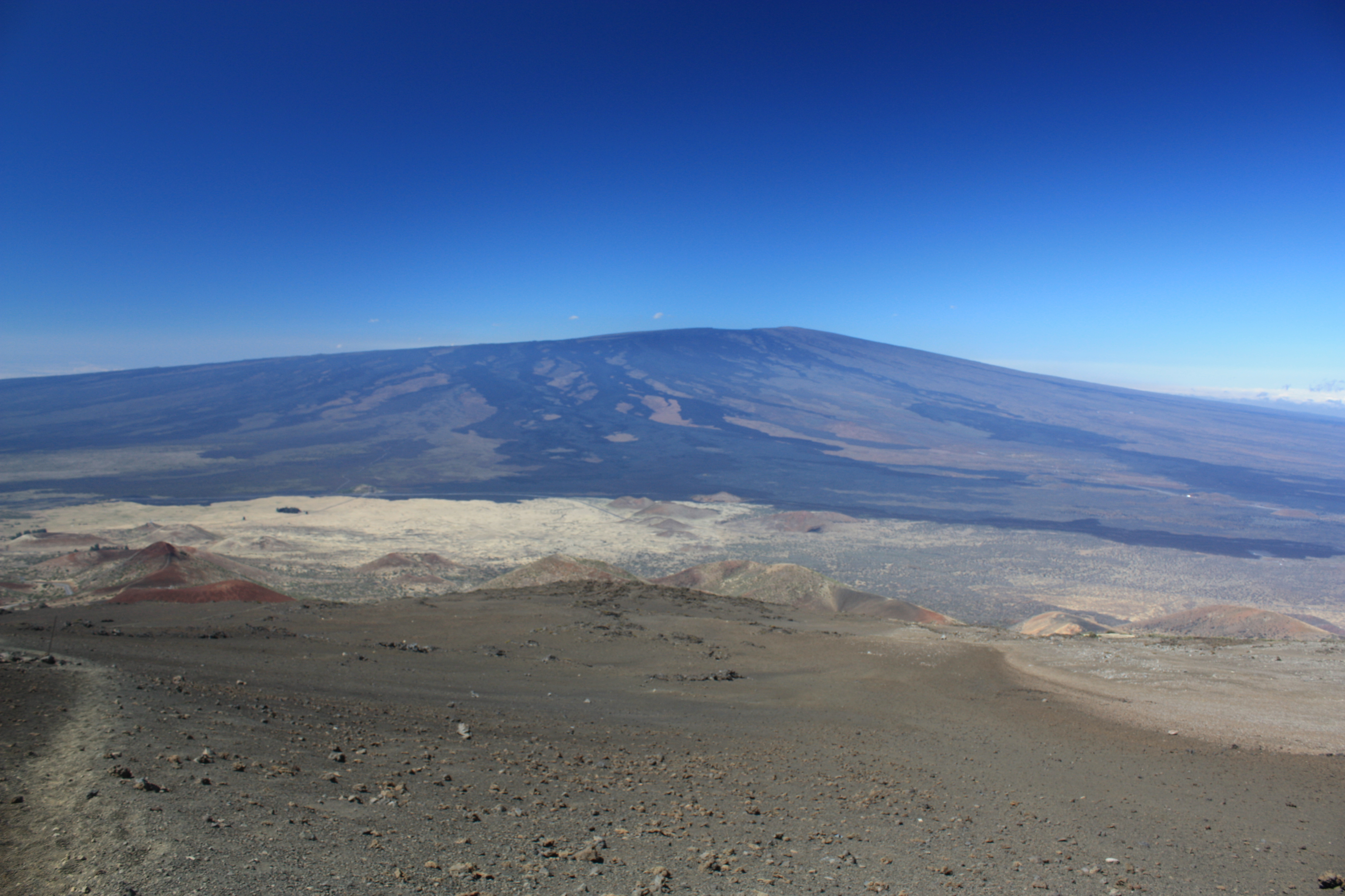
Mauna Loa
The largest subaerial volcano in both mass and volume, Mauna Loa has historically been considered the largest volcano on Earth. It is an active shield volcano with relatively gentle slopes, with a volume estimated at approximately 18,000 cubic miles. Although its peak is about 120 feet lower than that of its neighbor, Mauna Kea. Lava eruptions from Mauna Loa are silica-poor and very fluid, and they tend to be non-explosive. The volcano’s magma comes from the Hawaii hotspot, which has been responsible for the creation of the Hawaiian island chain over tens of millions of years.
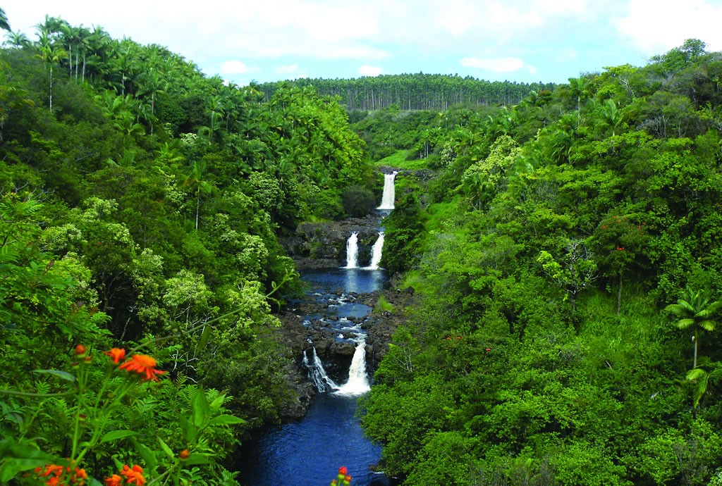
Umauma Falls
Unique in Hawaii as being a series of three waterfalls in close proximity. They are easily viewed from an overlook located on private botanical garden property accessible for a fee. The overlook was constructed in 1996 by Walter L. Wagner who was developing the World Botanical Gardens with the waterfalls overlook as part of the tourist attraction. Subsequently, the waterfall overlook ownership was transferred circa 2008, and access to the overlook is now through Umauma Experience (also a botanical garden), and not through World Botanical Gardens. The word Umauma means ‘constantly flowing’ in the Hawaiian language, and it is the most northernly river to have a continuous flow and not dry up during the dry season.
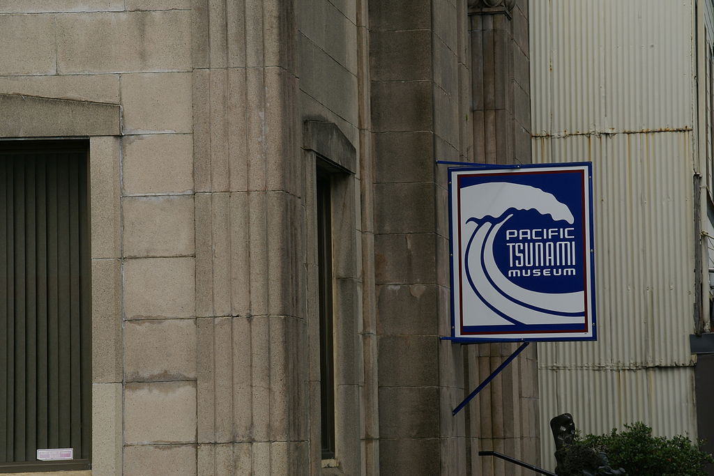
Pacific Tsunami Museum
A museum dedicated to the history of the April 1, 1946 Pacific tsunami and the May 23, 1960 Chilean tsunami, which devastated much of the east coast of the Big Island. The museum also has a mission to educate people in general about tsunamis, including the 2004 Indian Ocean earthquake and tsunami. It is located at 130 Kamehameha Ave.
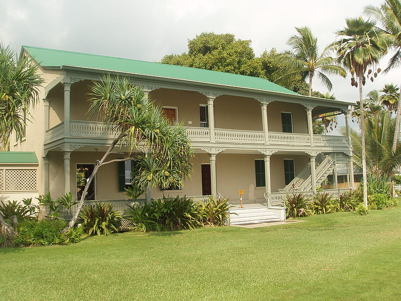
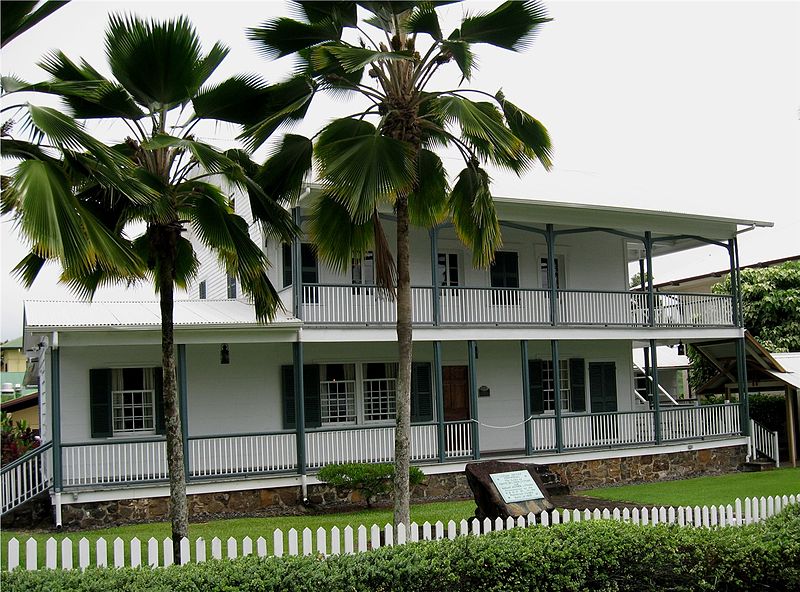
Hulihe’e Palace
Located in historic Kailua-Kona on Ali’i Drive, the former vacation home of Hawaiian royalty was converted to a museum run by the Daughters of Hawaiʻi in 1927, showcasing furniture and artifacts.
The palace was originally built by John Adams Kuakini, Governor of the island of Hawaiʻi during the Kingdom of Hawaii, out of lava rock.
Wao Kele o Puna
Hawai’i’s largest remaining lowland wet forest, about 15 mi south of the city of Hilo, along the East Rift Zone of Kīlauea volcano on the Island of Hawai’i. The name means the ‘upland rainforest of Puna‘. Puna is one of 9 districts on the island and lava from Kīlauea continues to flow onto forest land.
It is home to numerous primary and rare plant species including hāpuʻu ferns (Cibotium spp.), ʻieʻie vines (Freycinetia arborea), and kōpiko (Psychotria mariniana), some of which help to limit invasive species’ incursions. ʻOpeʻapeʻa (Hawaiian hoary bat, Lasiurus cinereus semotus) ʻio (Hawaiian hawk, Buteo solitarius), common ʻamakihi (Hemignathus virens), and nananana makakiʻi (happy-face spider, Theridion grallator) live in the trees. There are thought to be many more as-yet-undocumented species within the forest.
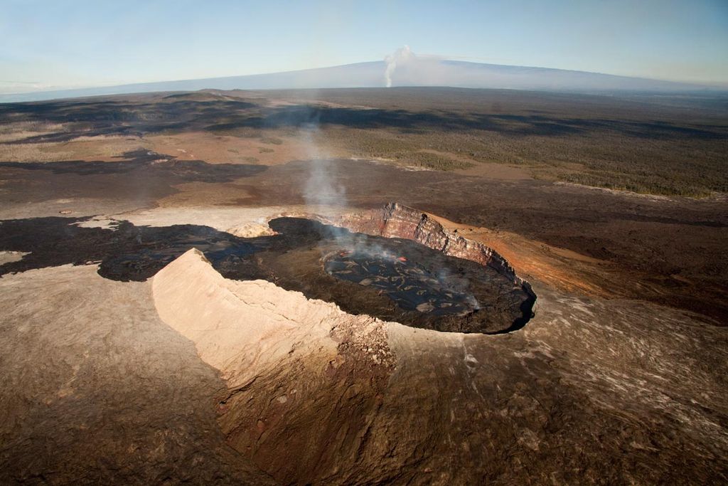
Kilauea
A currently active shield volcano in the Hawaiian Islands, and the most active of the five volcanoes that together form the island of Hawaiʻi. Located along the southern shore of the island, the volcano is between 300,000 and 600,000 years old and emerged above sea level about 100,000 years ago. Because it lacks topographic prominence and its activities historically coincided with those of Mauna Loa, Kīlauea was once thought to be a satellite of its much larger neighbor.
Its name means “spewing” or “much spreading” in the Hawaiian language, referring to its frequent outpouring of lava. The first well-documented eruption of Kīlauea occurred in 1823 (Western contact and written history began in 1778), and since that time the volcano has erupted repeatedly. Most historical eruptions have occurred at the volcano’s summit or its eastern rift zone, and are prolonged and effusive in character. The geological record shows, however, that violent explosive activity predating European contact was extremely common, and in 1790 one such eruption killed over 80 warriors!
In 1916, a bill forming the Hawaii Volcanoes National Park was signed into law by President Woodrow Wilson; since then the park has become a World Heritage Site and a major tourist destination, attracting roughly 2.6 million people annually.
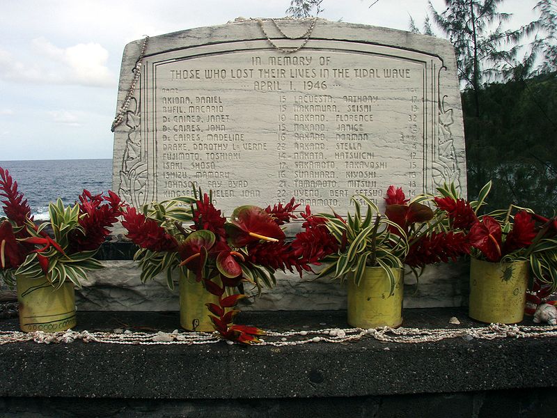
Laupāhoehoe
A census-designated place (CDP) in Hawaii County located in the District of North Hilo. The community’s name means “lava tip” and refers to the angular lava tip or cape formed by ancient pāhoehoe (smooth lava) flows which created the cape on which the community was built.
On April 1, 1946, the Big Island was struck by the so-called “April Fools Day tsunami”, originating from the Aleutian Islands earthquake. Approximately 160 people on the island were killed. While the greatest number of deaths occurred in Hilo, the school building at Laupāhoehoe was inundated, and twenty students and four teachers were drowned. A monument to the dead now stands on Laupāhoehoe Point.
Manuka State Wayside Park
A state park of 13.4 acres with an arboretum located approximately 19 miles west of Naʻalehu, on the Mamalahoa Highway (Route 11) section of the Hawaii Belt Road. The name means “blundering” in the Hawaiian Language, and was the name of the ancient land division (ahupa’a) that ran from a bay on the southwest side of the island up the slopes of the Mauna Loa volcano. The arboretum of 8 acres was originally planted in the mid-19th century with native and introduced plants. It now contains 48 species of native Hawaiian plants and more than 130 species of other exotic plants and flowers, and is surrounded by the 25,550-acre Manuka Forest Reserve.
Services at the park include restrooms, trash cans, and camping in an open shelter. No drinking water is available at the park.

Onizuka Center for International Astronomy
Also known as Hale Pōhaku, is a complex of support facilities for the telescopes and other instruments that comprise the Mauna Kea Observatory. few rustic cabins named Hale Pōhaku (which means “stone house” in the Hawaiian language) were built by the Civilian Conservation Corps on the southern slope of Mauna Kea in the 1930s for hunters and other explorers. A rough jeep trail was built in 1964 under Governor John A. Burns, and a small telescope determined that Mauna Kea would be an ideal place for an astronomical observatory. The Hale Pōhaku area was used as a construction camp for the building of the observatories through the 1970s, and the road realigned in 1975. A permanent complex of buildings was constructed in 1983 known as the Mid-Level Facility.
The Mid-Level Facility was renamed for the Hawaiʻi-born astronaut Ellison Onizuka, who died in the Space Shuttle Challenger disaster in 1986. It is located at the 9,300-foot elevation up Mauna Kea Access Road from the Saddle Road (Route 200). The center consists of dormitories with sleeping accommodation for 72, as well as a main building which houses the shared facilities such as cafeteria, laundry, and common room. Astronomers or technicians normally spend up to 24 hours at Hale Pōhaku to acclimatize to the altitude, before proceeding to the summit at almost 14,000 feet. The center is operated by the Institute for Astronomy of the University of Hawaii.
The VIS houses informational displays, and shows videos depicting the history and work of the observatories, as well as the geology, ecology and cultural significance of Mauna Kea. Every evening it hosts a stargazing program in which several small telescopes, up to 16 inches in diameter, are set up outside the building and visitors are shown various planets, star clusters, galaxies, nebulae and other interesting features of the night sky.
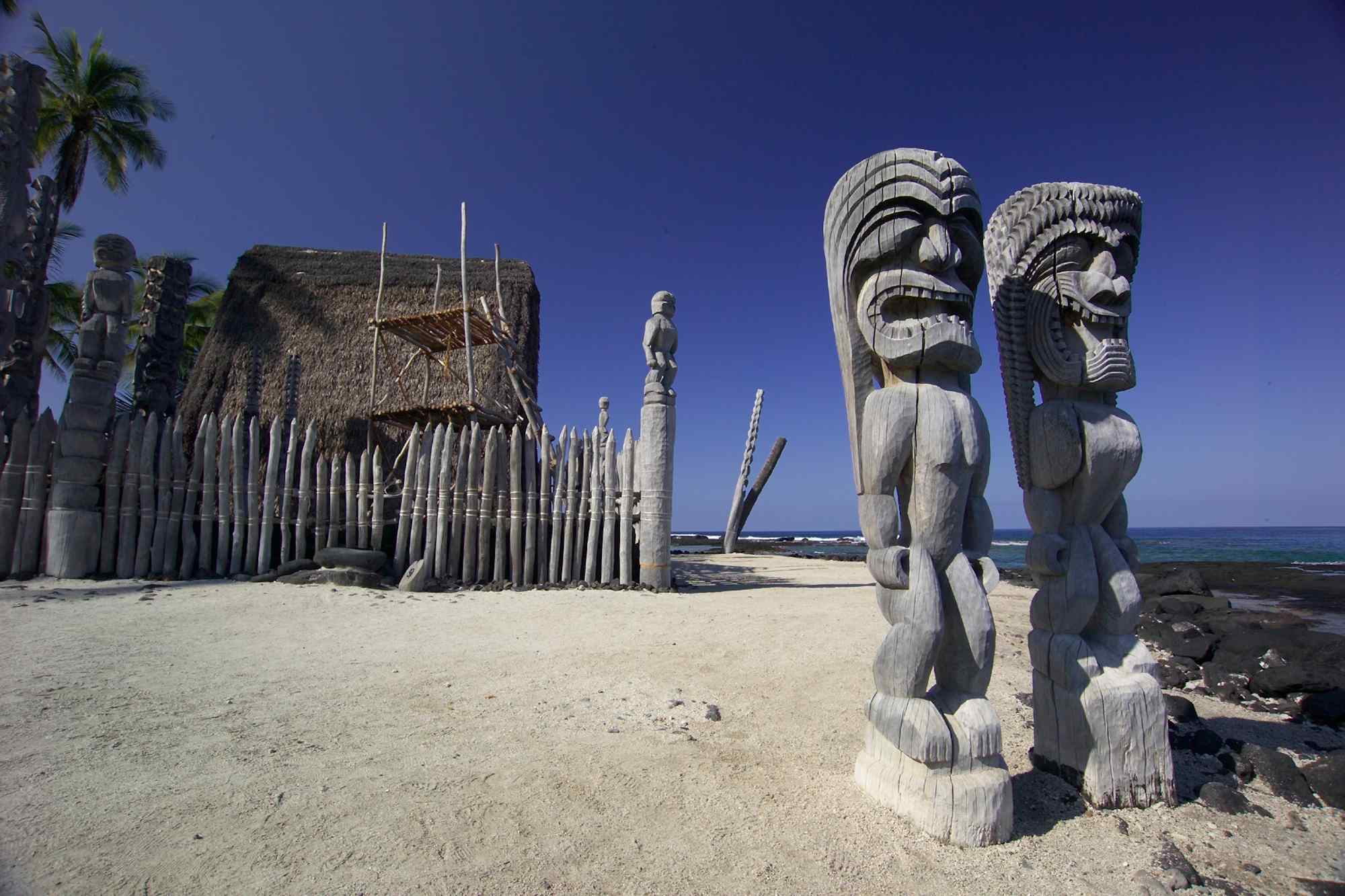
Puʻuhonua o Hōnaunau National Historical Park
Located on the west coast of the island of Hawaiʻi, this historical park preserves the site where, up until the early 19th century, Hawaiians who broke a ‘kapu’ (one of the ancient laws) could avoid certain death by fleeing to this place of refuge or puʻuhonua. The offender would be absolved by a priest and freed to leave. Defeated warriors and non-combatants could also find refuge here during times of battle. The grounds just outside the Great Wall that encloses the puʻuhonua were home to several generations of powerful chiefs.
The 420 acre site was originally established in 1955 as City of Refuge National Historical Park and was renamed on November 10, 1978. In 2000, the name was changed by the Hawaiian National Park Language Correction Act of 2000 observing the Hawaiian spelling. It includes the puʻuhonua and a complex of archeological sites including: temple platforms, royal fishponds, sledding tracks, and some coastal village sites. The Hale o Keawe temple and several thatched structures have been reconstructed.
Amy B. H. Greenwell Ethnobotanical Garden
A botanical garden near Captain Cook, Hawaii in the Kona District on the Big Island. The gardens, unfortunately, closed for the public on January 31st, 2016.
The 15-acre garden is owned by the Bernice P. Bishop Museum. It is located uphill (mauka) of the Hawaii Belt Road, known as Māmalahoa Highway or Hawaii Route 11, on the western slope of Mauna Loa. Amy Beatrice Holdsworth Greenwell was born in 1920 and was one of the 23 grandchildren of Henry Nicholas Greenwell (1826–1891), who arrived in Hawaii in the 1850s and became a successful merchant and rancher in the area. She attended Stanford University where she became a member of Gamma Phi Beta and served as a nurse WWII. After the war she worked with Otto Degener of the New York Botanical Garden on a book series titled “Flora Hawaiiensis” on Hawaiian plants. From 1953 to 1957 she served on a Historical Site Commission for the Territory. She also performed archaeology studies of early habitation sites of Hawaii including Ka Lae (South Point), and wrote other books on tropical plants. Later in her lifetime she transformed her property by planting native and Polynesian-introduced plants in the extant Hawaiian agricultural areas. She left the garden to the Bishop Museum on her death in 1974 to be opened to the public.
Today, the garden contains over 200 species of endemic, indigenous, and Polynesian-introduced plants that grew in Kona before Captain James Cook’s arrival. On certain days it is possible to take a guided tour during which the use and significance of the more important plants are explained. The garden’s landscape includes four ecological zones: coastal, dry forest, agricultural, and upland forest. Its native insect house features the Kamehameha butterfly.
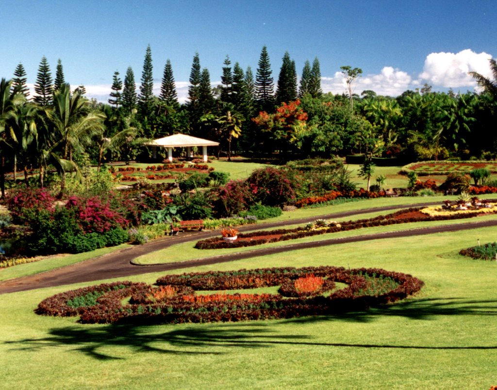
Nani Mau Gardens
Commercial botanical gardens located at 421 Makalika Street. They are open daily, and an admission fee is charged. The gardens’ name, Nani Mau, means “forever beautiful”. They were established by Makato Nitahara and opened to the public in 1972.
The gardens claim to contain more than 2,000 plant varieties, with approximately 225 types of flowering plants, including 100 species of fruit trees; and over 2,300 orchids, said to be one of the world’s largest collections of Paphiopedilum, Phalaenopsis, Epiphytes, Oncidium, and Cattleya orchids. The gardens also contain a number of trees planted by famous visitors.
Major garden features include an anthurium grove, Japanese-style bell tower (built from 20,000 boards without nails or screws), botanical museum, butterfly house, European garden, fruit orchard, ginger garden, hibiscus garden, Japanese gardens, orchid display, palms and coconut trees, and water garden.
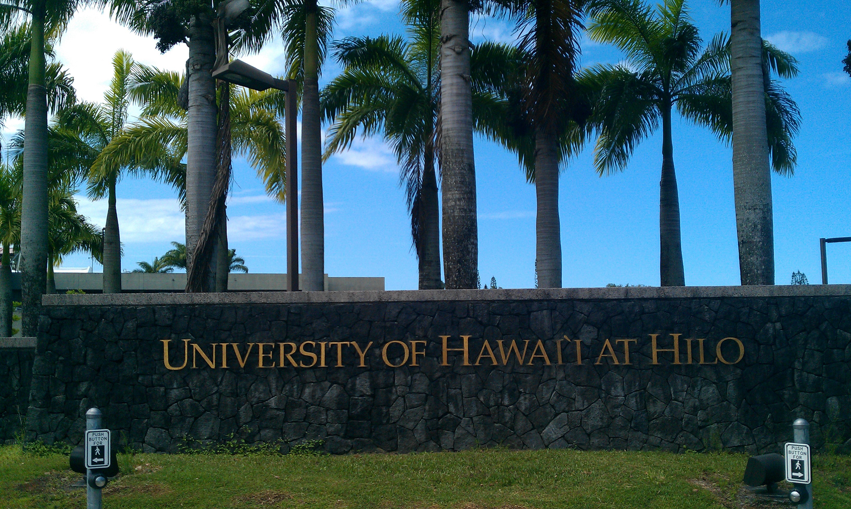
University of Hawaii at Hilo Botanical Gardens
Botanical gardens on the University of Hawaiʻi at Hilo campus, located at 200 West Kawili Street. They are open daily without charge.
The gardens were established by UH-Hilo professor Don Hemmes at some time in the 1980s. The gardens contain one of Hawaiʻi’s best cycad collections, with nearly a hundred species from Africa, China, North and Central America, and Australia. It also contains palm trees from around the world, with an almost complete collection of Hawaiian Pritchardia spp. including the endangered Loʻulu.
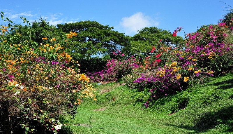
Pua Mau Place Arboretum and Botanical Garden
An early-stage, nonprofit arboretum and botanical garden located off Highway 270 at 10 Ala Kahua, Kawaihae, on the dry slopes of the Kohala Mountain Range. It is open daily with an admission fee.
The garden was established in 1974 by Dr. Virgil Place and friends to specialize in ever-blooming (pua mau) woody plants. Its stated mission is to promote awareness of, and conduct research on, the uses of flowering plants in a Hawaiian arid environment for ornamental, agricultural, and bio-regional purposes. The garden currently features a maze planted with over 200 varieties of hibiscus, outdoor sculpture, and an aviary with about 150 peafowl and guineafowl. Plants are marked and an information booklet is available.
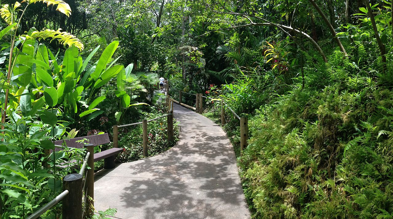
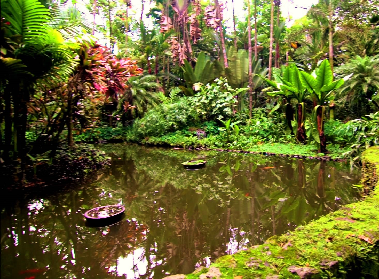
Hawaii Tropical Botanical Garden
A nonprofit botanical garden and nature preserve located on the 4 mile scenic route off of Route 19 at 27-717 Old Māmalahoa Highway, Pāpa’ikou. It is open daily except Thanksgiving, Christmas, and New Year’s Day. An admission fee is charged to the general public, those with a military I.D. are admitted free of charge.
The garden is located in a scenic valley opening out to Onomea Bay, and features streams, waterfalls and a boardwalk along the ocean. It was created by Dan J. Lutkenhouse, who purchased the property in 1977 and began to develop it as a botanical garden. It opened to the public in 1984, and was donated by the Lutkenhouses to a nonprofit trust in 1995.
Today the garden contains over 2,000 plant species, representing more than 125 families and 750 genera, with good collections of palms (nearly 200 species), heliconias (more than 80 species), and bromeliads (more than 80 species). The garden combines water and flora: A three-tiered waterfall (Onomea Falls) provides one of several water views which include Boulder Creek and the lava tubes on Onomea Bay.